What is Redistricting?
Every ten years, districts must be redrawn so that each district is substantially equal in population. This process, called redistricting, is important in ensuring that each board member represents about the same number of constituents. In Ventura County, the Board of Supervisors is responsible for adopting supervisorial districts. Redistricting will be based on data from the U.S. Census, expected to be released by September 30th. Under the Fair Maps Act, the County is required to complete the redistricting process by December 15, 2021.
Help shape the future of Ventura County’s Supervisorial Districts
Every ten years, U.S. Census data is used to redraw Ventura County Board of Supervisor district boundaries. This ensures the districts are balanced for changes in population. The Board of Supervisors wants to hear from you on how these boundaries should be drawn. Complete this the Community of Interest form to tell the Board about your community – keeping communities of interest together is a high-ranking criteria in the redistricting process.
Why does redistricting matter to me?
Redistricting determines which neighborhoods and communities are grouped together into a district for purposes of electing a board member. The Board of Supervisors will seek input in selecting the next district map for our supervisorial districts. You have an opportunity to share with the Board of Supervisors how you
think district boundaries should be drawn to best represent your community.
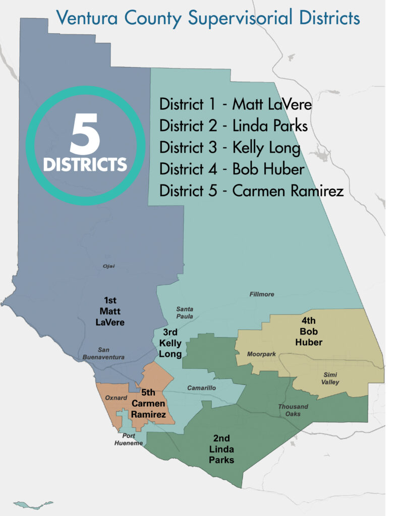
What do the existing supervisorial districts look like?
Supervisorial District Maps – Black and White / Color

What criteria will our Board of Supervisors
use when drawing district lines?
To the extent practicable, district lines will be adopted using the following criteria:
Geographically contiguous districts (each supervisorial district should share a common border with
the next)The geographic integrity of local neighborhoods or communities shall be respected in a manner that
minimizes its divisionGeographic integrity of a city shall be respected in a manner that minimizes its division
Easily identifiable boundaries that follow natural or artificial barriers (rivers, streets,
highways, rail lines, etc.)Lines shall be drawn to encourage geographic compactness
In addition, boundaries shall not be drawn for purposes of favoring or discriminating against a political party.


